


Drone Tree Survey in Nottingham and Derby — See Every Branch, Spot Every Risk, Book With Confidence
📞 Call Now:
0115-647-0351
Nottingham Tree Surgery and Arborist Services provides professional drone tree surveys across Nottingham, Derby, and the wider East Midlands.
From the ancient oaks near Sherwood Forest to the mature street trees lining West Bridgford and Mapperley, trees shape this region's character and carry real legal weight for property owners. A drone tree survey gives you a complete aerial picture of your trees — their health, structure, and risk — without a single climber leaving the ground.
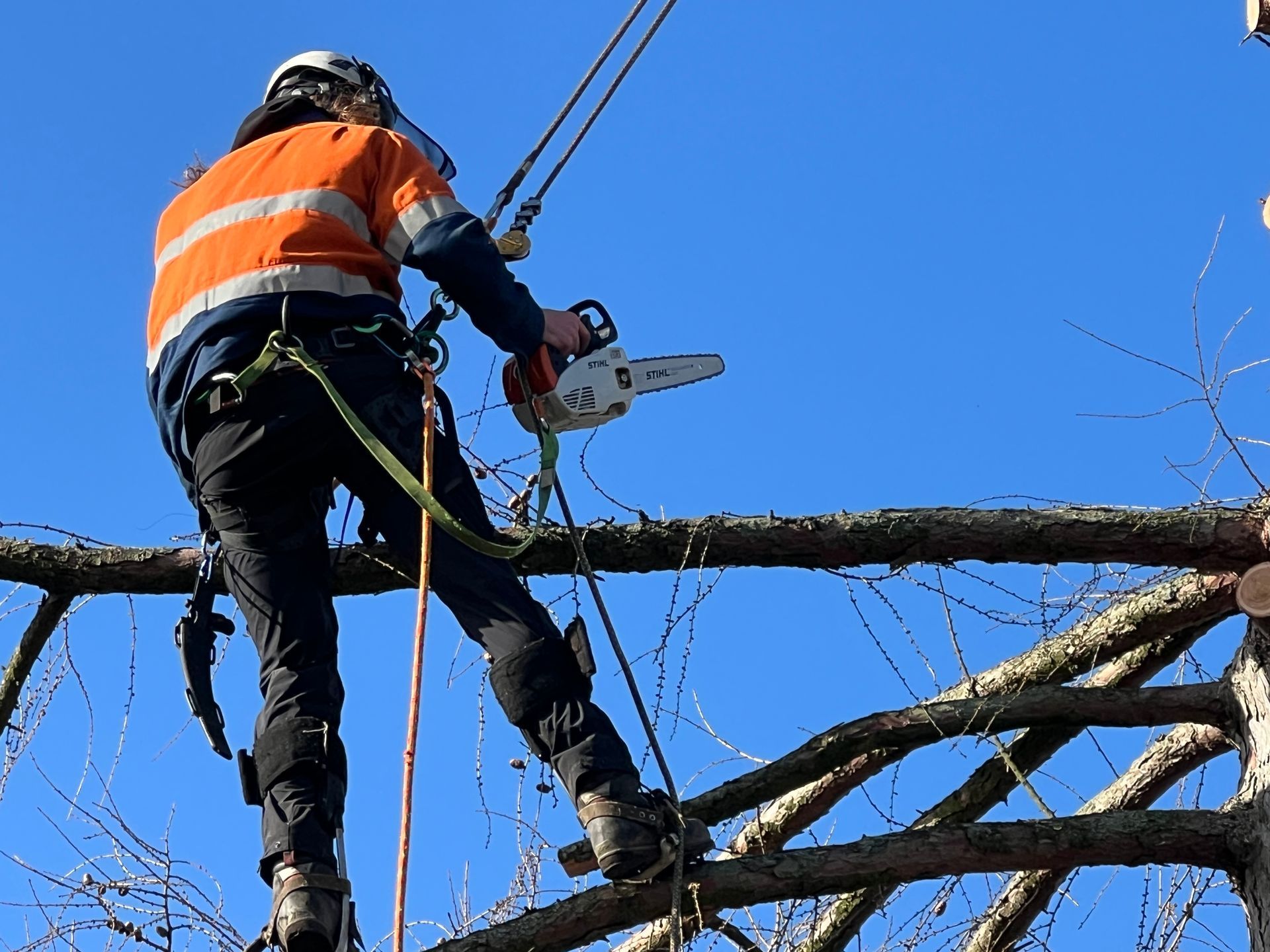
We use CAA-certified drone pilots who are also fully qualified arborists. That combination matters. The drone captures the data; our arboricultural expertise tells you what it means.
Whether you need a tree survey for a planning application, a risk assessment on a mature tree close to your property, or early detection of disease across a larger site — we can help.
Call us on
0115-647-0351 to arrange a site visit and free quote.


What Is a Drone Tree Survey?
A drone tree survey is an aerial inspection of trees carried out by a CAA-certified pilot using an unmanned aerial vehicle (UAV). The drone flies above and around the canopy, capturing high-resolution images and video from angles that no ground-based inspection can reach. The data is then analysed by a qualified arborist to produce a written report covering tree health, structural condition, and risk.
This service is used across Nottingham and Derby for:
- Tree risk assessments for homeowners and landlords
- BS5837 tree surveys for planning applications
- TPO and Conservation Area compliance documentation
- Pre-purchase and mortgage tree reports
- Disease and pest detection across large tree populations
- Insurance evidence and legal documentation
What a Drone Tree Survey Detects That Ground Inspections Miss
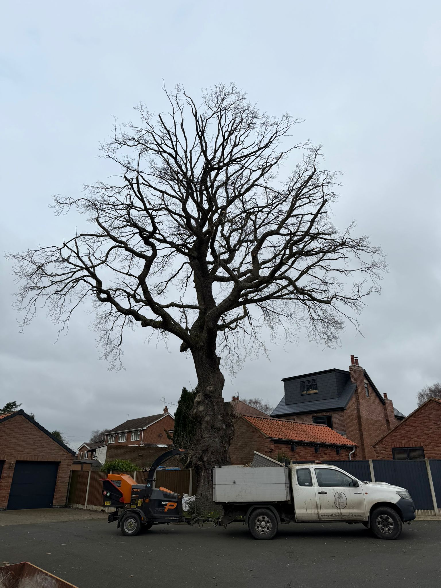
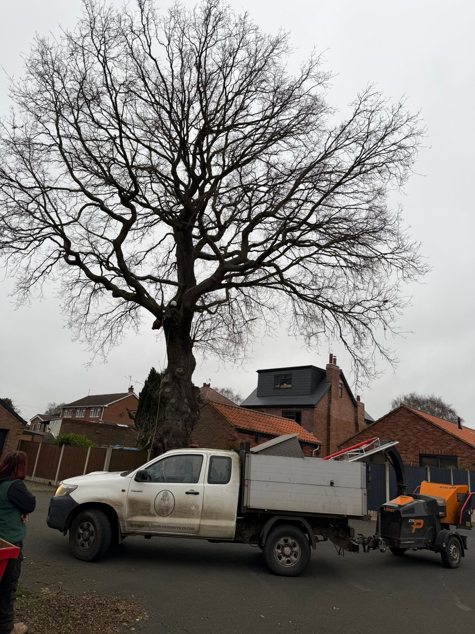
A standard ground-level inspection has limits. Standing beneath a tall oak or ash, even a trained arborist cannot always see cracks in the upper crown, fungal growth on high branches, or early signs of structural failure near the canopy top. Our drone removes that blind spot entirely.
Flying above and around the canopy, we capture high-resolution images and video from angles no ground survey can reach. Defects that would remain hidden — split unions, dead wood pockets, bracket fungi, and bark damage — show clearly from the air. For trees in Nottingham and Derby's older residential streets, where canopies often extend over roofs, fences, and footpaths, this level of detail matters.
Our drone surveys detect and document:
- Crown damage, dead wood, and structural splits
- Fungal growth and visible signs of decay
- Canopy lean and crown spread measurements
- Tree height and proximity to buildings or power lines
- Root Protection Area (RPA) mapping for planning purposes
- Bark abnormalities, epicormic growth, and dieback patterns
- Overhanging branches near highways, power lines, and structures
A drone survey does not replace a full arboricultural assessment. It works alongside it — giving our qualified team the aerial evidence needed to make better decisions about your trees.
Why Nottingham and Derby Property Owners Book a Drone Survey First
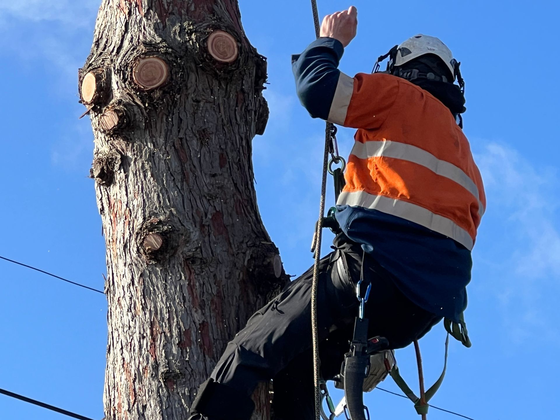
A Safer, Faster Alternative to Climbing
Many tree problems are discovered late. A homeowner in Mapperley notices a crack in a branch overhanging the garden. A landlord in Carlton sees discolouration in a large tree near a boundary fence. By the time either calls an arborist, the issue may have developed further than a quick ground inspection can fully assess.
A drone survey changes that sequence. We fly first, gather aerial evidence, and produce a clear picture of what is actually happening in the upper canopy. When our arborist visits the site, they arrive knowing exactly where to look. That cuts assessment time, reduces the chance of missed defects, and gives you a sharper recommendation from the outset.
For Nottingham's Victorian and Edwardian housing stock — common across Sherwood, Sneinton, and Hyson Green — and Derby's older residential areas in Mickleover, Allestree, and Littleover, trees are often large, mature, and growing in tight spaces next to older buildings. Access for climbing inspections is not always practical. In those situations, a drone survey is the safer, faster alternative. There is no climbing equipment, no risk to the arborist at height, and no disruption to the property beyond the drone's flight time.
Legal Duty of Care for Commercial Property Owners
If you manage a commercial site, school, care home, or housing estate in Nottingham or Derby, regular tree inspections are not just good practice — they are a legal requirement. The Occupiers Liability Acts of 1957 and 1984 place a duty on landowners to manage foreseeable tree risk. The Health and Safety at Work Act 1974 extends this to commercial premises. Drone surveys provide the dated, documented evidence that insurers and authorities require.
How a Drone Tree Survey Supports BS5837 Planning Applications
If you are developing land in Nottingham or Derby where trees are present, a BS5837 tree survey is almost always required before your planning application can proceed. Nottingham City Council, Derby City Council, and Nottinghamshire and Derbyshire County Councils all require accurate tree data — including canopy spread, Root Protection Areas, and tree condition — before they can assess the impact of development on protected or valuable trees.
Drone aerial imagery plays a direct role in BS5837 compliance:
- When a topographical survey has not been commissioned, our drone captures orthorectified aerial images used as a base map for the Tree Constraints Plan
- 3D photogrammetry models show planning officers exactly how trees relate to proposed development footprints
- Drone evidence reduces planning delays caused by incomplete or challenged tree data
- Aerial imagery can be the difference between planning approval and refusal
We also handle
TPO and Conservation Area applications directly. Nottingham and Derby both have numerous protected trees across their neighbourhoods. Our drone survey evidence supports these applications with dated, high-resolution photographic records — valuable for planning approval and for any future queries.
How Drone Technology Reads Tree Health
What the Camera Sees
Our drone cameras capture high-resolution colour imagery that reveals visible stress signals before they become serious problems. Changes in leaf density, unusual crown die-back, and discolouration that suggests pest or fungal activity all appear clearly in aerial footage.
Multispectral Imaging — Beyond What the Eye Can See
Where standard photography reaches its limits, we can deploy multispectral imaging. This records wavelengths outside the visible spectrum and flags chlorophyll loss — one of the earliest measurable signs that a tree is under stress — before the naked eye can detect any change.
Repeated drone flights over the same site build a time-series record of how tree health changes over time. That data supports long-term management planning and gives commercial clients in Nottingham and Derby objective evidence for decisions about their tree stock.
How Drone Surveys Catch Disease and Pests Before Damage Spreads
Ash Dieback Across Nottinghamshire and Derbyshire
Ash dieback (Hymenoscyphus fraxineus) is now widespread across both counties — from transport corridors along the A52 and A60 to parkland trees in Wollaton and Gedling, and rural Derbyshire woodland near Belper and Matlock. It does not always show its worst effects from the ground until the disease is well advanced. From the air, crown die-back patterns, sparse canopy, and epicormic growth at the base are visible much earlier.
Our drone surveys are used to map ash populations, identify trees showing early signs of decline, and prioritise which require urgent action. Targeted action costs less than emergency felling and keeps more trees standing for longer.
Other Diseases and Pests We Detect from the Air
Beyond ash dieback, our aerial surveys identify:
- Phytophthora root and collar rot — visible as canopy thinning and leaf scorch
- Honey fungus — bracket or bootlace growth patterns visible at the tree base
- Oak processionary moth — silk nest clusters in the upper canopy
- Storm damage and wind-throw risk — crown imbalance and hidden splits
- Bleeding canker on horse chestnut — bark staining visible in close aerial imagery
Early detection gives you options. Treated early, many diseases can be managed. Left undetected, the same trees become liabilities. Our pest and disease control service follows directly from survey findings — diagnosis and treatment from the same qualified team.
What to Expect on the Day
A drone tree survey is a straightforward process. There is no heavy equipment, no scaffolding, and no need to close access around the site.
Here is what a typical survey day looks like:
- Arrival and pre-flight check — our pilot confirms the flight plan, checks wind conditions, and clears the immediate area
- Airspace confirmation — we verify controlled airspace restrictions before launch; proximity to East Midlands Airport and Derby Airport means this step is always completed in advance
- Flight — the drone flies a planned grid or orbit pattern, capturing images and video of every tree in scope
- Ground data collection — our arborist records additional measurements and observations from ground level
- Data transfer — imagery is downloaded and logged on site before we leave
Most residential and small commercial sites are completed in under two hours. Larger sites may require additional flight time.
We confirm the full scope and timings with you before the survey day.
The Survey Report: What You Receive
The drone is a data-gathering tool. The report is what you actually use. Every drone tree survey we complete produces a written report from a qualified arborist — not just a folder of aerial photographs.
Your report includes:
- High-resolution aerial imagery of the full canopy and individual trees
- Annotated site map with tree positions, canopy spreads, and flagged defect locations
- Written risk assessment covering each tree's condition and recommended actions
- BS5837-compatible data where the survey is for planning purposes, including RPA mapping
- Photographic evidence suitable for insurance claims, legal documentation, or planning submissions
- A schedule of trees with condition ratings and management recommendations
If you need additional arboricultural documents, we produce these alongside the drone survey report:
- Arboricultural Impact Assessment (AIA)
- Tree Protection Plan (TPP)
- Arboricultural Method Statement (AMS)
Reports are typically delivered within
five working days of the survey flight. If your project has a planning deadline, tell us at the point of booking.
Frequently Asked Questions About Drone Tree Surveys
What does a drone tree survey involve?
A drone tree survey uses a UAV flown by a CAA-certified pilot to capture high-resolution aerial imagery and video of your trees. A qualified arborist then analyses the footage and produces a written report covering tree health, structure, risk, and management recommendations.
How accurate is a drone tree survey compared to a ground inspection?
Drone surveys detect defects in the upper crown and canopy that ground inspections regularly miss — including structural splits, bracket fungi, crown die-back, and bark damage at height. For sites where access is difficult, a drone survey provides more complete data than a ground-level assessment alone.
Can a drone tree survey be used for a BS5837 planning application?
Yes. Our drone surveys capture orthorectified aerial imagery and tree data that meet BS5837 requirements. This includes canopy spread, tree positions, and Root Protection Area mapping accepted by Nottingham City Council, Derby City Council, and local planning authorities across Nottinghamshire and Derbyshire.
Do I need CAA permission to have a drone tree survey carried out on my property?
No. As the property owner or land manager, you do not need to obtain CAA permission. Our pilots hold the necessary CAA certifications and insurance to carry out commercial drone operations legally. We handle all airspace checks and flight planning.
What time of year is best for a drone tree survey?
Late autumn and winter surveys reveal structural defects more clearly once the leaves have dropped — ideal for risk assessments and pre-planning work. Spring and summer surveys are better for health and disease detection when the canopy is in full leaf. We carry out drone tree surveys year-round across Nottingham and Derby.
Will the drone fly over my neighbour's property?
Our flight plans are designed to stay within the agreed survey boundary. Where a neighbouring property is directly adjacent, we discuss this with you in advance and plan the flight accordingly.
How soon will I receive my report?
Reports are delivered within five working days of the survey flight. If your project has a planning or insurance deadline, tell us at the point of booking and we will prioritise your report.
Is a drone survey suitable for a single tree?
Yes. We carry out drone surveys for individual trees and large multi-site estates alike. The scope and flight plan are tailored to your specific site and requirements.
Can drone surveys help with insurance claims involving trees?
Yes. Dated, high-resolution aerial photographs and a written arborist report provide strong supporting evidence for insurance claims involving tree damage, boundary disputes, or negligence assessments.
What is the difference between a drone tree survey and a tree inspection?
A tree inspection is typically a ground-level visual assessment carried out by an arborist. A drone tree survey adds an aerial dimension — capturing canopy-level detail that a ground inspection cannot reach.
The two are most effective when used together, which is why our drone surveys always include ground data collection by a qualified arborist on the same visit.
Areas We Cover For Drone Tree Surveys
We carry out drone tree surveys across Nottingham, Derby, and the surrounding East Midlands. Our teams are local to the area and can usually arrange a site visit within a few days of your enquiry.
Nottingham and Nottinghamshire
We cover Nottingham City Centre (NG1), West Bridgford (NG2), Beeston (NG9), Arnold (NG5), Carlton (NG4), Mapperley (NG3), Gedling (NG4), Hucknall (NG15), Stapleford (NG9), Long Eaton (NG10), Eastwood (NG16), Kirkby in Ashfield (NG17), and Mansfield (NG18).
Derby and Derbyshire
We cover Derby City Centre (DE1), Allestree (DE22), Mickleover (DE3), Littleover (DE23), Chaddesden (DE21), Spondon (DE21), Ilkeston (DE7), Ripley (DE5), Belper (DE56), Heanor (DE75), and Alfreton (DE55).
Not sure if we cover your area? Call us on 0115-647-0351 and we will confirm same day.
Book Your Drone Tree Survey Today
If you have trees on your property or development site in Nottingham or Derby, there has never been a better time to book a drone tree survey. Whether you need a risk assessment before winter, aerial evidence for a planning application, or a health check on mature trees showing signs of stress — our qualified team is ready to help.
Here is what happens when you call:
- We discuss your site and requirements — no jargon, no pressure
- We arrange a free site visit and quote at a time that suits you
- Your survey is booked and carried out promptly
- Your written report is delivered within five working days
Call Nottingham Tree Surgery and Arborist Services today on 0115-647-0351.
Or complete our online enquiry form and we will respond within 24 hours.
20 Prince Street, Long Eaton, Nottingham, NG10 4LH